A traffic radar sensor should be specified around the intersection or roadway decision it supports: vehicle presence, extension, counting, speed, queue, stopped vehicle, approach warning, or trajectory data. The procurement must define zones, outputs, mounting, interfaces, ground truth, and edge cases rather than accept a generic detection claim.
Table of Contents
- Define the Traffic Decision and Required Output
- Match Radar Capability to the Detection Zone
- Engineer Mounting, Occlusion, and Multipath Controls
- Specify Data, Controller, and Platform Interfaces
- Compare Radar-Only and Radar-Video Configurations
- Commission With Ground Truth and Edge Cases
- Procure for Lifecycle Accuracy, Not a Detection Claim
- FAQs
Define the Traffic Decision and Required Output
Start with the controller, analyst or safety action. Presence at a stop bar, approach extension, count and classification, speed measurement, queue length, stopped-vehicle warning and trajectory analytics are not interchangeable. Name the zone, lane, direction, minimum dwell, update rate, latency and action created by each output.
Specify the required data record: event state, timestamp, lane or zone, speed, direction, class, confidence, track identifier and sensor health. Define which values are mandatory in real time and which may arrive as an aggregated report. If the radar drives a signal controller, identify fail-safe behavior and maximum tolerated delay.
The FHWA Traffic Detector Handbook documents the operating principles and application tradeoffs of detector technologies. Although individual products have advanced, its engineering discipline remains useful: detector selection follows the required traffic-management function and site conditions.
Match Radar Capability to the Detection Zone
Do not infer outputs from “radar” alone. Continuous-wave implementations are commonly used for motion and speed; FMCW and more advanced processing can add range, tracks and zone logic. Ask the supplier to identify waveform class, field of view, range and velocity resolution, update rate, target capacity, direction handling and stopped-target behavior for the proposed version.
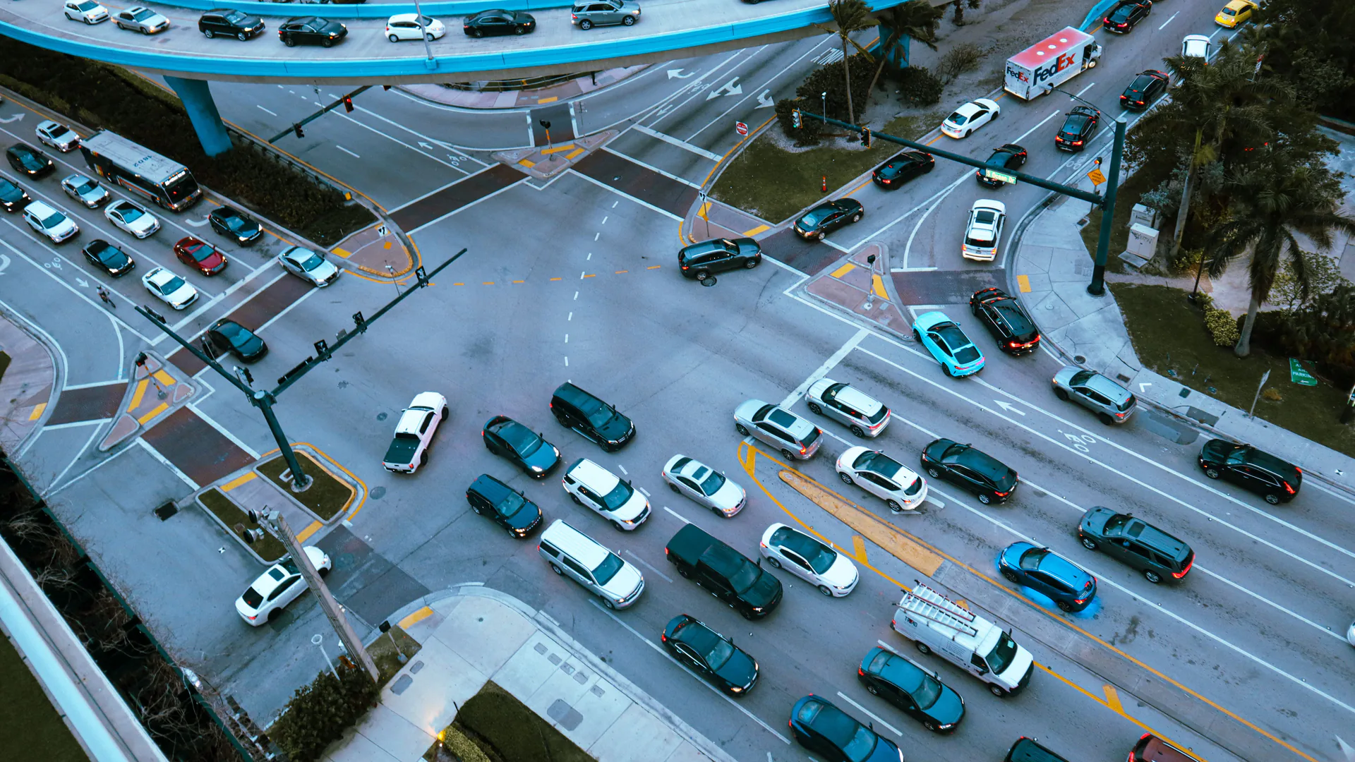
Draw every detection and exclusion zone on a scaled plan. Include lane widths, stop bars, turn pockets, grades, medians, roadside furniture and likely queues. Define behavior when one vehicle masks another, a large truck spans zones, a bicycle travels near a vehicle, or a vehicle stops at the edge.
| Application | Required radar output | Ground truth | Acceptance concern |
|---|---|---|---|
| Stop-bar presence | Occupancy by lane/zone and dwell | Time-coded lane observation | Spillover and stopped-target loss |
| Count/classification | Event, direction and class | Independently reviewed video/sample | Occlusion and class confusion |
| Speed | Track or event speed with position | Traceable reference instrument | Angle and acceleration bias |
| Queue | Tail location or zone occupancy over time | Time-coded queue reference | Lane changes and dense traffic |
| Safety warning | Approach/trajectory with bounded latency | Instrumented or surveyed scenario | False activation and late event |
A sensor should be scored for each contracted output. High count accuracy does not prove stop-bar presence or a collision-warning latency.
Engineer Mounting, Occlusion, and Multipath Controls
Mounting position determines line of sight, footprint and angle. Record height, offset, tilt, azimuth, structure vibration and clearance from signs or luminaires. Model tall vehicles, opposing traffic and queues that can hide smaller road users. Preserve safe maintenance access and avoid creating a new roadside hazard.
Reflections from metal structures, guardrails, walls and large vehicles can create multipath. Moving vegetation or nearby roads can contaminate zones. Use exclusion areas and sensitivity settings, but verify that tuning does not remove slow or small targets that matter.
FHWA’s detector installation guidance emphasizes installation variables and field considerations. Apply current product instructions and agency standards to the actual mounting design; legacy guidance is a framework, not a substitute for delivered-device evidence.
Specify Data, Controller, and Platform Interfaces
List electrical, network and logical interfaces: power, surge protection, relay or detector-card outputs, Ethernet, serial, protocol, API, cybersecurity, time synchronization and configuration management. State whether the sensor or central platform owns zone logic, aggregation and health monitoring.
Define event semantics. An occupied zone may use latching, minimum presence, debounce or timeout rules that differ by supplier. Provide examples with timestamps and expected controller states. For track data, define coordinate axes, origin, units, update behavior and unique identifiers.
Require remote health without exposing unsafe administration. Log configuration changes, authentication and failures. Keep a recoverable baseline and define who may retune zones after resurfacing, lane changes or construction. Data ownership and export should be explicit when a cloud service is used.
Compare Radar-Only and Radar-Video Configurations
Radar-only designs can provide motion and range-related data without depending on visible-light contrast and may reduce image-retention concerns. A camera can add scene verification, classification context and a ground-truth record, but introduces lighting, privacy, bandwidth, storage, cleaning and cybersecurity requirements.
If the buyer has not yet selected radar over tubes, loops, video or another counting method, use the road traffic counter guide first. This page starts after radar is a credible candidate and owns radar-specific zones, mounting, interfaces and field commissioning.
The TRVF8221 radar-video fusion sensor and TRVF8221-SCO traffic-flow detector are reference configurations for fused measurement and flow applications. The TRSW8233 collision alert unit represents a local warning use case. Confirm field of view, data, latency and test results for the exact configuration.
Use the radar-video traffic sensor architecture guide when designing the wider fusion and data path. This article’s boundary is the sensor procurement, mounting and site acceptance decision.
Commission With Ground Truth and Edge Cases
Specify the commissioning dataset before installation:
| Dataset slice | Reference method | Report separately |
|---|---|---|
| Free-flow vehicles | Time-synchronized reviewed video or approved reference sensor | Lane, direction, class and speed band |
| Queue and stop-and-go | Reviewed track/event timeline | Stops, creep, close following, occupancy and queue state |
| Turns and lane changes | Surveyed zones plus reviewed trajectories | Entry/exit zone, track continuity and double count |
| Small or vulnerable road users | Reviewed truth set when included in scope | Bicycle/motorcycle/pedestrian class and occlusion condition |
| Empty and clutter periods | Long no-target observation with event log | False calls by source, zone and tuning state |
| Degraded system states | Controlled network, power, clock or sensor interruption | Alarm, buffering, recovery and duplicate/missing record |
Freeze the truth file and calculate results from the exported sensor record, not a live demonstration screen. Retain configuration, firmware, zone map and clock evidence with the score.
Create a time-synchronized independent record. Depending on the metric, use reviewed video, manual classification samples, a reference speed device, surveyed positions or instrumented test vehicles. Define sample size and confidence before testing. Keep a portion blind to the installer.
Test normal and difficult states: free flow, dense queues, stop-and-go, turns, lane changes, large and small vehicles, motorcycles or bicycles where in scope, slow movement, full stops, close following, dawn/dusk, rain and relevant seasonal conditions. Include empty-road time to measure false events.
Score detection and false-event rates, count error, class confusion, speed error, zone spillover, stopped-target continuity, latency, availability and recovery. The FHWA Traffic Signal Program Handbook places detection within the larger discipline of operating and maintaining a signal program; commissioning records should therefore support ongoing performance management.
Procure for Lifecycle Accuracy, Not a Detection Claim
Normalize bids to installed, commissioned zones and accepted data outputs. Include poles or brackets, traffic control, cabling, cabinet work, surge protection, communications, software, licenses, training, calibration or verification, spares, support and periodic retesting. Price lane reconfiguration and another intersection as unit rates.
Set maintenance triggers for moved hardware, resurfacing, changed markings, construction, firmware, vegetation and persistent data drift. Monitor health and compare periodic samples with ground truth. A system that cannot reveal its degraded state should not silently feed safety or planning decisions.
Use the smart city and transportation solution to connect sensing with operations and review the smart-transportation product category for application-specific configurations. The resource center can organize interface and acceptance evidence. For a detection-zone plan and ground-truth commissioning protocol, contact OMNI UXV with site drawings, traffic decisions, controller interfaces, target classes, latency and environmental conditions.
FAQs
Can every traffic radar sensor detect stopped vehicles?
No. Capability depends on waveform, processing, configuration and scene; buyers must state the required dwell time and prove stopped-vehicle performance in the intended zone.
What is the difference between CW and FMCW traffic radar?
A basic continuous-wave design is commonly associated with motion and speed, while frequency-modulated continuous-wave systems can derive range-related information, but actual outputs depend on the product implementation.
Does a vehicle detection radar need a camera?
Not always. Radar can operate without visible-light imagery, while radar-video fusion can add classification and review context when privacy, lighting, bandwidth and evidence requirements are addressed.
How should traffic radar accuracy be acceptance-tested?
Compare time-synchronized radar outputs with an independent ground-truth record across lanes, vehicle classes, speeds, queues, stops, occlusion and weather, using pre-agreed metrics.